BOAT/MOTOR
SALES/SERVICE
  Statesboro, GA


FISHING CHARTERS   Savannah, GA


INFORMATION SITES


Providing
FREE On-Line Sea Surface Temperature Charts
Since 1999


All charts include analysis
All temperatures corrected by correlation with buoy readings

Please Note: Charts are usually updated after 11pm Eastern Time.


Yes, we ARE still here.
Life in these crazy times have kept
us too busy elsewhere lately,
BUT
Updates will be made more regularly
(cloud cover permitting)
moving into the fall season.


Sea Surface Temperature Charts
PDF-B&W, Printable ~ Java-Color, Interactive ~ HTML-Color, Non-interactive

     11/29/20 AM   North East Coast    PDF    Java    HTML
     11/29/20 AM   NY/Mass Coast    PDF    Java    HTML
     11/29/20 AM   New Jersey Coast   PDF    Java    HTML
     11/29/20 AM   DE/MD/VA Coast    PDF    Java    HTML
     11/29/20 AM   South East Coast    PDF    Java    HTML
     11/29/20 AM   North Carolina Coast   PDF    Java    HTML
     11/29/20 AM   NC/SC Border Coast   PDF    Java    HTML
     11/29/20 AM   South Carolina Coast   PDF    Java    HTML
     11/29/20 AM   Georgia Coast    PDF    Java    HTML
     11/29/20 AM   NorthEast Florida Coast   PDF    Java    HTML
     11/29/20 AM   Central East Florida Coast   PDF    Java    HTML
     11/29/20 AM   SouthEast Florida Coast   PDF    Java    HTML
     11/29/20 AM   Bahama Islands    PDF    Java    HTML


Front
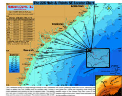
Locator Chart With Fishing Tips
Back
Detailed Chart With Fishing Points
Blue Water
SC & GA
Artificial/
Near Shore Reefs
SC & GA
Inshore
Savannah, GA Area
FAQs

How To Use Sea Surface Temperature Charts


Fishing Reports, Tide Tables, Solunar Table

Sea Conditions & Forecasts

Fishing and Gear Tips, Charts and Waypoints

Weather - Radar and Satellite Images,Forecasts

Clubs, Fishing Information and Other Sites of Interest


Advertising Information

About HotSpots Charts, LLC Sea Surface Temperature Charts

HotSpots Charts, LLC Legal Notices


E-Mail HotSpots Charts, LLC